How to Open a Layer
Overview
Layers or feature classes can be opened and made visible in Spatial AI from multiple sources. Users can open a SQL Layer stored in a SQL server spatial database, open a shape file layer stored on their computer or other file storage area (F drive), or open a layer file stored on a map server.
Need More Help?
For personalized assistance, speak with a customer service representative or join our monthly training session.
Workflows
Open a Map Layer
First, ensure that the layer is not already open in the Map Explorer by selecting the Map TOC tab in the Map Explorer frame and look for the layer in the list of open layers.
If the layer is absent, add the layer as follows:
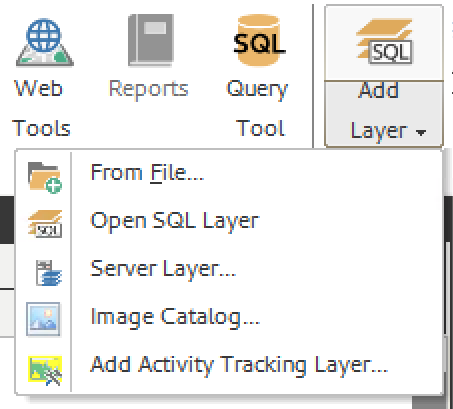
Step 1: Select the “Add Layer” button in the ribbon. Five options will appear in the dropdown menu: “From File…”, “Open SQL Layer”, “Server Layer…”, “Image Catalog”, and “Add Activity Tracking Layer.”

Step 2: Select from the menu which type of layer you want to add. A dialogue window will appear.


